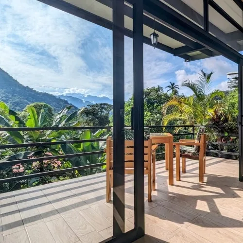
Mindo sits at roughly 1,300 m on the western slope of the Andes, on the edge where the high mountains fall toward the Pacific lowlands. That single fact explains almost everything about its weather: mild temperatures that barely move all year, and moisture that arrives almost daily in some form.
The altitude, precisely
Town and the surrounding valley sit around 1,300 m. For context, Quito is at 2,850 m — about 1,500 m higher. Coming from Quito, Mindo feels noticeably warmer and thicker with air; it's also a natural acclimatization stop in the other direction, which is part of why travelers like to do Quito, then Mindo, then fly to the Galápagos or the coast.
Birding here often spans three altitudes in a single day — roughly 1,100 m, 1,800 m and 2,500 m — because different species bands live at each level. That vertical range is one reason the Chocó Andino holds so many birds in so little space, and we explain it in birding the Chocó Andino.
Temperature: the constant
| Typical | |
|---|---|
| Daytime | About 21°C |
| Nighttime | About 14°C |
| Variation across the year | Minimal |
This is the part travelers find hard to believe: the difference between January and July in Mindo is smaller than the difference between a sunny and a cloudy afternoon. You're near the equator at moderate altitude, and the cloud cover moderates everything. Pack layers for the evening, not for the season.
Rain: the variable
The pattern is directional rather than dramatic: frequent rain runs from late October through April, and the middle of the year is drier. Neither half is dry or wet in an absolute sense — a cloud forest earns its name by wringing moisture out of the air year-round, so a brief shower can happen in any month.
We deliberately don't publish month-by-month rainfall figures for Mindo. Reliable monthly statistics aren't published for the area, and we won't invent numbers. Check current conditions close to your travel date; the qualitative pattern above is the dependable part.
Why it's always cloudy
Cloud forests form where moist air is pushed up the Andes' western slope, cools as it rises, and condenses into persistent cloud and mist at these elevations. The forest itself recycles much of that moisture. Practical consequences you'll actually notice:
- Mornings are often clearer than afternoons — the best birding and photography light comes early
- Humidity is high even without rain: lenses fog, clothes dry slowly, ziplock bags earn their place
- The mist is not bad weather. It's the machinery that makes the ecosystem, and most of the birds and orchids exist because of it
What this means for your body
- Altitude is a non-issue for most people at 1,300 m. If you've just arrived in Quito and felt the thin air there, Mindo is a relief rather than a challenge.
- The activities ask for fair fitness, not athleticism. Trails are muddy in patches and the waterfall route involves climbing steps. If you can walk a couple of hours on uneven ground, you're fine.
- Sun is sneaky. Near the equator, a clear morning at 1,300 m burns faster than the mild temperature suggests.
When to come, given all this
Since temperature is a constant, the seasons question is really about rain frequency and visitor volume. We cover the trade-offs in best time to visit Mindo, and month by month in the month guides. The short version: there is no month when Mindo doesn't work, and no month when a rain jacket is optional.
How the climate shapes what you'll do
Rain changes the texture of a day, rarely cancels it. Birds feed actively during and after light rain; waterfalls are fullest in and just after the wet season; the zipline runs in drizzle. The honest planning rule: build one flexible activity per day and let the shower decide which one it is. Our Mindo FAQ covers the what-if-it-rains questions in detail.
- What to pack for the cloud forest
- Best time to visit Mindo
- Mindo cloud forest guide
- Mindo in January — the wet season in practice
Facts checked: September 2026